Published On Aug 29, 2022
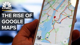
Google Maps helps more than 1 billion people a month get around. Beneath the simple interface, Google is pulling billions of data points to get the most accurate route for users. After 17 years in users’ hands, mapping technology continues to advance and get more accurate.
WSJ explains how Google Maps uses advanced technology like satellites, GPS data and photogrammetry to help you get from point A to point B.
Illustration: Adele Morgan
0:00 There are roughly 50 million updates a day to Google Maps
0:59 Google Maps’ aggressive acquisitions
2:16 How satellites, aerial imagery and photogrammetry are used
6:10 Google Maps’ privacy concerns
7:40 The future of mapping
Tech Behind
'The Tech Behind' explores the amazing engineering, computing, science and algorithms that power our favorite tech.
#Google #GoogleMaps #WSJ